
- Plan, book, fly with confidence
- Be in the knowGet alerts if flight prices drop or rise*
- Book smarterSave on select hotels after you book a flight*
- Find the right fitWe search billions of combinations of flights to help you find your next adventure
Hotels near Santa Ynez Airport

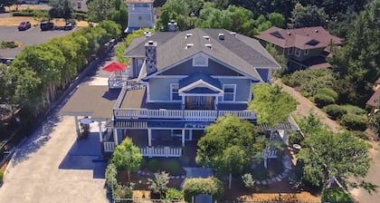
3627 Sagunto Street, Santa Ynez, CA
The price is AED 1,021 per night from Apr 22 to Apr 23
AED 1,021
AED 1,342 total
includes taxes & fees
22 Apr - 23 Apr
Stay at this 4-star business-friendly B&B in Santa Ynez. Enjoy free breakfast, free WiFi, and free parking. Our guests praise the breakfast and the helpful staff ...
9.6/10 Exceptional! (461 reviews)
1121 Edison Street, Santa Ynez, CA
The price is AED 1,256 per night from Apr 15 to Apr 16
AED 1,256
AED 1,550 total
includes taxes & fees
15 Apr - 16 Apr
Stay at this 3.5-star B&B in Santa Ynez. Enjoy free breakfast, free WiFi, and free parking. Our guests praise the helpful staff in our reviews. Popular attractions ...
9.6/10 Exceptional! (46 reviews)

3400 East Highway 246, Santa Ynez, CA
The price is AED 460 per night from Apr 28 to Apr 29
AED 460
AED 535 total
includes taxes & fees
28 Apr - 29 Apr
Stay at this 4-star spa resort in Santa Ynez. Enjoy free WiFi, free parking, and a full-service spa. Our guests praise the pool and the helpful staff in our ...
9.2/10 Wonderful! (1,611 reviews)
Lowest nightly price found within the past 24 hours based on a 1 night stay for 2 adults. Prices and availability subject to change. Additional terms may apply.
Santa Ynez Airport
Current conditions at Santa Ynez Airport
Show map
Airport Information
Name: Santa Ynez Airport
Location: Santa Ynez, United States
- Longitude: 34.60694
- Latitude: -120.07556
Airport Codes:
- IATA: SQA
- ICAO: KIZA
Nearby Airports
- Santa Barbara Municipal Airport (SBA)
- Santa Maria Public Airport (SMX)
- San Luis Obispo County Regional Airport (SBP)
- Oxnard Airport (OXR)
- Santa Paula Airport (SZP)
- Meadows Field Airport (BFL)
- Van Nuys Airport (VNY)
- Hollywood Burbank Airport (BUR)
- Los Angeles Intl. Airport (LAX)
- Hawthorne Municipal Airport (HHR)