
- Plan, book, fly with confidence
- Be in the knowGet alerts if flight prices drop or rise*
- Book smarterSave on select hotels after you book a flight*
- Find the right fitWe search billions of combinations of flights to help you find your next adventure
Hotels near Montrose Regional Airport

1980 North Townsend, Montrose, CO
The price is AED 715 per night from May 31 to Jun 1
AED 715
AED 819 total
31 May - 1 Jun
includes taxes & fees
Stay at this hotel in Montrose. Enjoy free breakfast, free WiFi, and free parking. Our guests praise the helpful staff in our reviews. Popular attractions Airport ...
8.8/10 Excellent! (718 reviews)

25 TRIBUTARY STREET, Montrose, CO
The price is AED 694 per night from May 25 to May 26
AED 694
AED 795 total
25 May - 26 May
includes taxes & fees
Stay at this hotel in Montrose. Enjoy free breakfast, free WiFi, and free parking. Popular attractions Montrose Lions Park and Airport Industrial Park are located ...
9.6/10 Exceptional! (136 reviews)
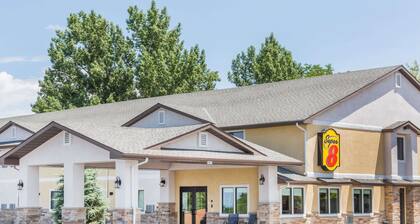
1705 E Main St, 1/2 Mile West Of City Limits Of Hwy 50, Montrose, CO
The price is AED 284 per night from May 19 to May 20
AED 284
AED 326 total
19 May - 20 May
includes taxes & fees
Book a stay at this business-friendly motel in Montrose. Enjoy free breakfast, free WiFi, and free parking. Our guests praise the helpful staff and the clean ...
8/10 Very Good! (1,008 reviews)
Lowest nightly price found within the past 24 hours based on a 1 night stay for 2 adults. Prices and availability subject to change. Additional terms may apply.
Montrose Regional Airport
Current conditions at Montrose Regional Airport
Show map
Airport Information
Name: Montrose Regional Airport
Location: Montrose, United States
- Longitude: 38.510287
- Latitude: -107.896955
Airport Codes:
- IATA: MTJ
- ICAO: KMTJ
Airport Map Photo Gallery

Nearby Airports
- Telluride Regional Airport (TEX)
- Gunnison-Crested Butte Regional Airport (GUC)
- Grand Junction Regional Airport (GJT)
- Pitkin County Airport (ASE)
- Animas Air Park Airport (AMK)
- Montezuma County Airport (CEZ)
- La Plata County Airport (DRO)
- Eagle County Regional Airport (EGE)
- Canyonlands Field Airport (CNY)
- Four Corners Regional Airport (FMN)